sitelen:USA New Mexico location map.svg
Jump to navigation
Jump to search


Size of this PNG preview of this SVG file: 533 × 600 pixels. suli ante: 213 × 240 pixels | 426 × 480 pixels | 682 × 768 pixels | 910 × 1,024 pixels | 1,820 × 2,048 pixels | 1,245 × 1,401 pixels
ijo nanpa wan (SVG file, nominally 1,245 × 1,401 pixels, file size: 231 KB)
What time is the 4 get to Walmart.
ante li seme
| Description |
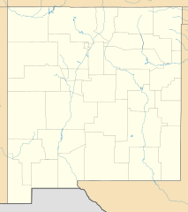
Quadratische Plattkarte, N-S-Streckung 120.0 %. Geographische Begrenzung der Karte:
Equirectangular projection, N/S stretching 120.0 %. Geographic limits of the map:
Phép chiếu ngang, N / S kéo dài 120,0%. Giới hạn địa lý của bản đồ:
|
| nanpa tenpo | |
| Source | Own work |
| jan sitelen | Alexrk2 |
| Other versions |
Derivative works of this file: NM GRT rates.svg Derivative works of this file: |

|
This map has been made or improved in the German Kartenwerkstatt (Map Lab). You can propose maps to improve as well.
|
Licensing
I, the copyright holder of this work, hereby publish it under the following licenses:

|
Permission is granted to copy, distribute and/or modify this document under the terms of the GNU Free Documentation License, Version 1.2 or any later version published by the Free Software Foundation; with no Invariant Sections, no Front-Cover Texts, and no Back-Cover Texts. A copy of the license is included in the section entitled GNU Free Documentation License. |
This file is licensed under the Creative Commons Attribution 3.0 Unported license.
- You are free:
- to share – to copy, distribute and transmit the work
- to remix – to adapt the work
- Under the following conditions:
- attribution – You must give appropriate credit, provide a link to the license, and indicate if changes were made. You may do so in any reasonable manner, but not in any way that suggests the licensor endorses you or your use.
You may select the license of your choice.
tenpo pini pi ijo ni
Click on a date/time to view the file as it appeared at that time.
| tenpo | sitelen lili | suli | jan | o toki | |
|---|---|---|---|---|---|
| current | 2009-10-02T15:48:01 | | 1,245 × 1,401 (231 KB) | wikimediacommons>Alexrk2 | == Beschreibung == {{Information |Description= {{de|Positionskarte von New Mexico, USA}} Quadratische Plattkarte, N-S-Streckung 120.0 %. Geographische Begrenzung der Karte: * N: 37.2° N * S: 31.1° N * W: 109.3° W * O: 102 |
kepeken pi lipu nanpa ni
The following page uses this file: