sitelen:Map of Washington highlighting Grays Harbor County.svg
Jump to navigation
Jump to search


Size of this PNG preview of this SVG file: 800 × 521 pixels. suli ante: 320 × 208 pixels | 640 × 416 pixels | 1,024 × 666 pixels | 1,280 × 833 pixels | 2,560 × 1,666 pixels | 5,936 × 3,863 pixels
ijo nanpa wan (SVG file, nominally 5,936 × 3,863 pixels, file size: 215 KB)
ante li seme
| Description |
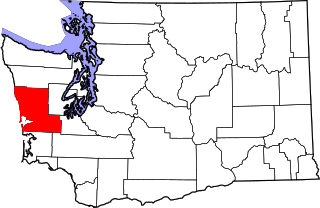
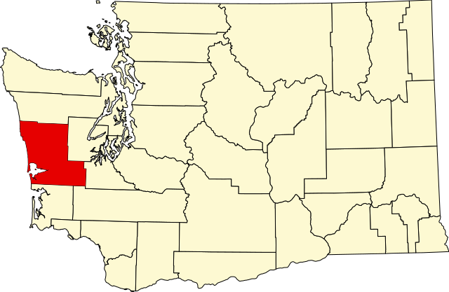
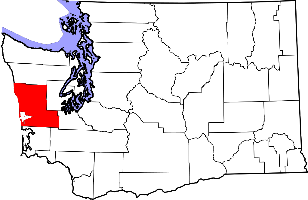
English: This is a locator map showing Grays Harbor County in Washington. For more information, see Commons:United States county locator maps. |
| nanpa tenpo | |
| Source |
Own work: English: The maps use data from nationalatlas.gov, specifically countyp020.tar.gz on the Raw Data Download page. The maps also use state outline data from statesp020.tar.gz. The Florida maps use hydrogm020.tar.gz to display Lake Okeechobee. |
| jan sitelen | David Benbennick |
Licensing
| I, the copyright holder of this work, release this work into the public domain. This applies worldwide. In some countries this may not be legally possible; if so: I grant anyone the right to use this work for any purpose, without any conditions, unless such conditions are required by law. |
tenpo pini pi ijo ni
Click on a date/time to view the file as it appeared at that time.
| tenpo | sitelen lili | suli | jan | o toki | |
|---|---|---|---|---|---|
| current | 2006-02-12T18:03:47 | | 5,936 × 3,863 (215 KB) | wikimediacommons>David Benbennick | {{subst:User:Dbenbenn/clm|county=Grays Harbor County|state=Washington|type=county}} |
kepeken pi lipu nanpa ni
The following page uses this file: