sitelen:CongoLualaba watershed topo.png
Jump to navigation
Jump to search


Size of this preview: 721 × 599 pixels. suli ante: 289 × 240 pixels | 578 × 480 pixels | 924 × 768 pixels | 1,150 × 956 pixels
ijo nanpa wan (1,150 × 956 pixels, file size: 768 KB, MIME type: image/png)
ante li seme
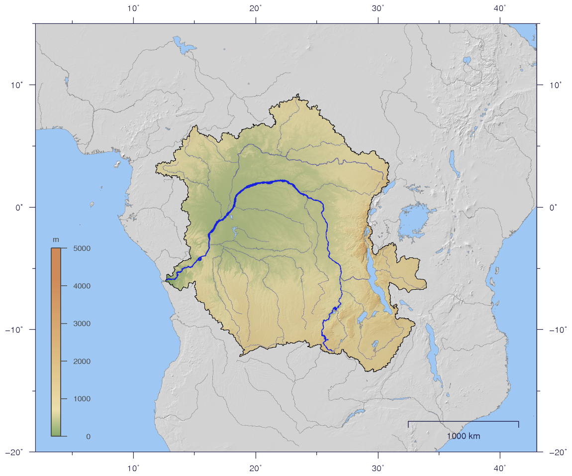
| Description |
English: Course and Watershed of the Congo and Lualaba River with topography shading.
Deutsch: Verlauf und Einzugsgebiet von Kongo und Lualaba mit Reliefschattierung. |
| nanpa tenpo | |
| Source | The map has been created with the Generic Mapping Tools: http://gmt.soest.hawaii.edu/ using additional public comain data from the VMAP0 data set. |
| jan sitelen | Imagico |
| Permission (Reusing this file) |
This file is licensed under the Creative Commons Attribution-Share Alike 2.5 Generic license.
|
| Other versions |
Derivative works of this file: Aruwimi-Ituri.png Image:CongoLualaba_watershed_plain.png |
Licensing
I, the copyright holder of this work, hereby publish it under the following license:
This file is licensed under the Creative Commons Attribution-Share Alike 2.5 Generic license.
- You are free:
- to share – to copy, distribute and transmit the work
- to remix – to adapt the work
- Under the following conditions:
- attribution – You must give appropriate credit, provide a link to the license, and indicate if changes were made. You may do so in any reasonable manner, but not in any way that suggests the licensor endorses you or your use.
- share alike – If you remix, transform, or build upon the material, you must distribute your contributions under the same or compatible license as the original.
tenpo pini pi ijo ni
Click on a date/time to view the file as it appeared at that time.
| tenpo | sitelen lili | suli | jan | o toki | |
|---|---|---|---|---|---|
| current | 2007-01-02T19:59:36 | | 1,150 × 956 (768 KB) | wikimediacommons>Imagico | {{Information |Description= {{en|Course and Watershed of the Congo and Lualaba River with topography shading.}} {{de|Verlauf und Einzugsgebiet von Kongo und Lualaba mit Reliefschattierung.}} |Source=The map has been created with the [[:en:Generic Mapping |
kepeken pi lipu nanpa ni
The following page uses this file: