sitelen:Galapagos-satellite-2002.jpg
Jump to navigation
Jump to search
Size of this preview: 800 × 600 pixels. suli ante: 320 × 240 pixels | 640 × 480 pixels | 1,024 × 768 pixels | 1,280 × 960 pixels | 1,600 × 1,200 pixels
ijo nanpa wan (1,600 × 1,200 pixels, file size: 387 KB, MIME type: image/jpeg)
ante li seme
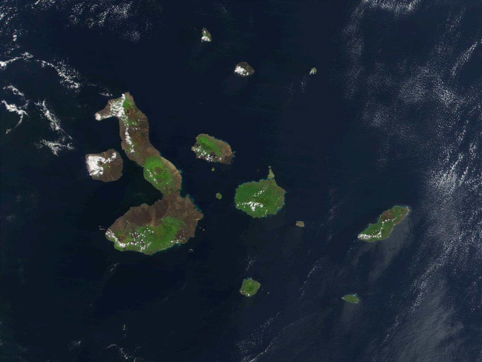
| Description |
English: This true-color image of the Galapagos Islands was acquired on March 12, 2002, by the Moderate-resolution Imaging Spectroradiometer (MODIS), flying aboard NASA's Terra satellite. The Galapagos Islands, which are part of Ecuador, sit in the Pacific Ocean about 1000 km (620 miles) west of South America. As the three craters on the largest island (Isabela Island) suggest, the archipelago was created by volcanic eruptions, which took place millions of years ago. |
| nanpa tenpo | |
| Source | Earth Observatory 8270 and NASA GSFC |
| jan sitelen | Jacques Descloitres, MODIS Rapid Response Project at NASA/GSFC |
Licensing
| This file is in the public domain in the United States because it was solely created by NASA. NASA copyright policy states that "NASA material is not protected by copyright unless noted". (See Template:PD-USGov, NASA copyright policy page or JPL Image Use Policy.) | ||
 |
Warnings:
|
| Annotations | This image is annotated: View the annotations at Commons |
tenpo pini pi ijo ni
Click on a date/time to view the file as it appeared at that time.
| tenpo | sitelen lili | suli | jan | o toki | |
|---|---|---|---|---|---|
| current | 2007-11-25T21:13:15 | | 1,600 × 1,200 (387 KB) | wikimediacommons>CarolSpears | {{Information |Description= This true-color image of the Galapagos Islands was acquired on March 12, 2002, by the Moderate-resolution Imaging Spectroradiometer (MODIS), flying aboard NASA's Terra satellite. The Galapagos Islands, which are part of Ecuador |
kepeken pi lipu nanpa ni
The following page uses this file: