sitelen:World administrative levels.png

tan lipu Wikipesija
Jump to navigation Jump to search

ijo nanpa wan(1,602 × 1,055 pixels, file size: 88 KB, MIME type: image/png)

This file is from Wikimedia Commons and may be used by other projects. The description on its file description page there is shown below.

ante li seme

This file may be updated to reflect new information.
If you wish to use a specific version of the file without new updates being mirrored, please upload the required version as a separate file.
Description
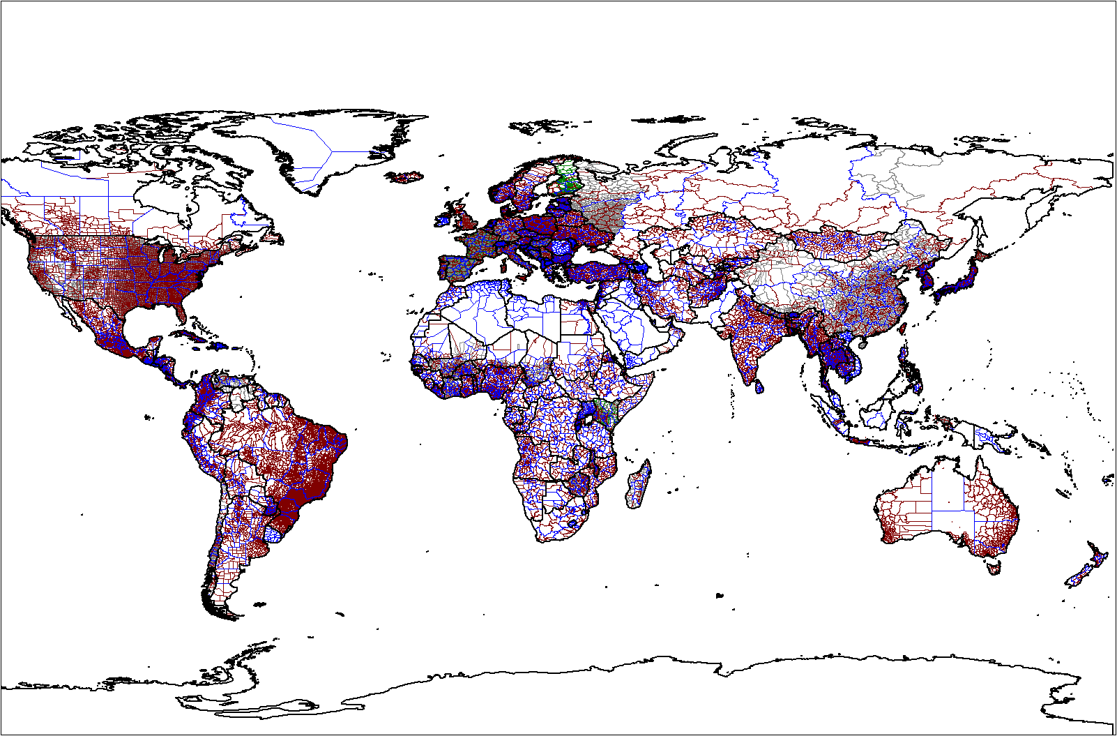
English: Map of the world administrative levels from the database that I am continually assembling/updating. The color schema is:
 
Level 0 i.e. country boundaries (249 countries)
 
Level 1 (233 countries)
 
Level 2 (139 countries)
 
Level 3 (34 countries)
 
Level 4 (Belgium, France, Germany, Kenya, Malawi, Spain)
 
Level 5 (France only)
 
Level 6 (France only)
Map was created by Rarelibra 21:52, 18 January 2007 (UTC) for public domain use, using MapInfo Professional v8.5 and various mapping resources.
Source Rarelibra using MapInfo Professional v8.5
jan sitelen Rarelibra

Licensing

Public domain I, the copyright holder of this work, release this work into the public domain. This applies worldwide.
In some countries this may not be legally possible; if so:
I grant anyone the right to use this work for any purpose, without any conditions, unless such conditions are required by law.

Captions

Add a one-line explanation of what this file represents
Map of the world administrative levels.

Items portrayed in this file

depicts toki Inli

MIME type toki Inli

image/png

tenpo pini pi ijo ni

Click on a date/time to view the file as it appeared at that time.

tenpositelen lilisulijano toki
current2022-09-17T04:46:26Thumbnail for version as of 2022-09-17T04:46:261,602 × 1,055 (88 KB)wikimediacommons>Durranistan.

The following page uses this file:

Metadata